
This is not really a hike but the trail shows you how to reach the ruins of the old fortress called Erasmo-Kulishta between Ohrid and Struga. Nevertheless, with 250 m ascent it’s still not a walk in the park!
I had read about the existence of the ruins of this fortress in the scientific archeological paper by Barbora Weissova et al, named “The Frontier Studies. Survey of the Northern Part of the Lake Ohrid Basin, Preliminary Report on the Season 2017” in Studia Hercynia XXII/1, 99-133. I don’t think many people are aware of these ruins!
The fortress is described as follows in this paper (I edited the text a bit):
St. Erasmo‑Kulishta, a Hellenistic fortress, when discovered erroneously interpreted as Lychnidos (Lychnidos is the old name for Ohrid; The Hellenistic period spans the period between the death of Alexander the Great in 323 BC and the emergence of the Roman Empire in 31 BC).
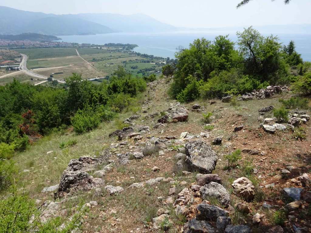
It occupies 10 hectares on a high hill (880 m) directly overlooking Lake Ohrid. The hill protrudes from the Gabavski Hillock which divides the Ohrid and Struga plains.
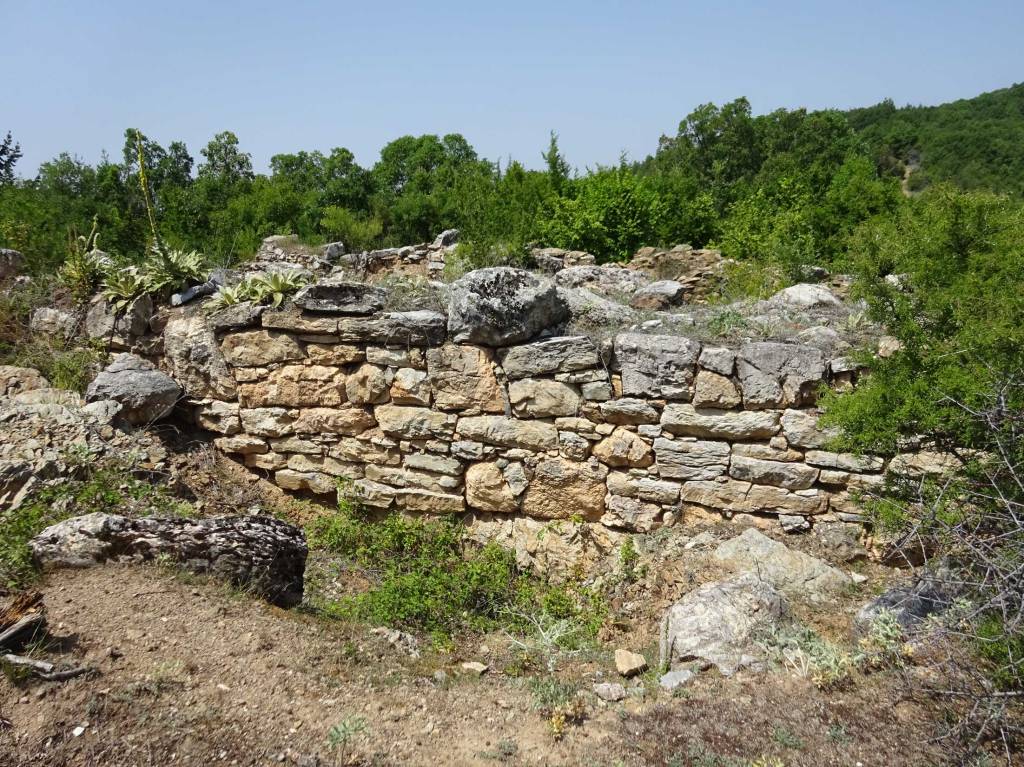
The fortress consists of an acropolis on the western part of the hill and an adjacent area in the east. While the former was uncovered for the first time in 1932, two more excavation seasons focusing on the examination of the outer bailey took place in 2008–2010. However, the recent archeological excavation addressed solely the northern fortification wall and, thereby, left the central and southern part of the site without further investigation in terms of a complex stratigraphic sequence.
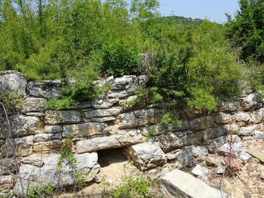
The northern excavated part of the fortress features massive cyclopean walls built in opus quadratum, variant pseudoisodomum, which reach a thickness of about 2×2 m. A watchtower of regular shape strengthens the fortification each 32 m. The outer perimeter of every watchtower is 8×8 m, the inner 4×4 m. (We could not find these structures when we were on the ground).
The main gate is located in the north‑eastern part of the outer bailey. The southern, ‘lake part’, of the fortification wall was uncovered partially and it is of much smaller dimensions. It seems that the settlement was well protected from here by a rocky slope.

The walled acropolis, situated in the western part of the hill, is of a polygonal shape (with dimensions 42x32 m). In the east, the acropolis walls are reinforced and reach a width of approx. 1.5 m. A small entrance / gate connecting the outer bailey and the acropolis is located here. In the south, the wall is complemented by a watchtower (6.5x4.5 m).
The earliest phase of the settlement (fortified at that time?) dates back to the 1st half of the 1st millenium BC. The massive ramparts and the acropolis were built in the second half of the 4th century BC as confirmed by Hellenistic pottery and coins from the reign of Philip II, Alexander, and Cassander. Life in the settlement faded before the arrival of the Romans at the end of the 3rd century BC.
We first visited the ruins of the Basilica St Erasmus along the road between Ohrid and Struga. The plan was to walk from there to the fortress on the hill above the Basilica. However, it seemed that the trail that I had initially planned passed through a garbage dump and we decided to approach the fortress from the east, using a dirt-road starting from the road between the villages Orman and Dolno Lakocherej. Also along this dirt-road there unfortunately was quite some garbage.
Although there is not much left of the fortress that must have been really impressive in its days, I really enjoyed this site. In the distance, on the next hill, you can see the much better conserved Tsar Samoil’s Fortress of Ohrid.
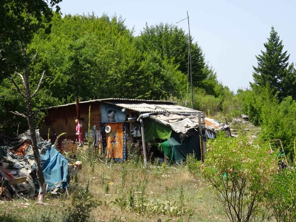
There is a little makeshift hut on the site that is used by the archeologists who apparently are still exploring the site. I noticed several fragments of antique pottery while walking over this archeological site.
The views of Lake Ohrid are very nice from this high location and it easy to understand the strategic advantage of a fortress on this site.

The GPS track that I made takes you along several structures that I had identified and marked as waypoints using Google Earth. If you follow the GPS trail you’ll be taken along these structures as well. I can highly recommend to check out the site using Google Earth before you visit, to get an idea of what to expect. On the ground it’s so much more difficult to get an overview!

A visit to this archeological site can be conveniently combined with:
- The ruins of the St Erasmus Basilica along the way between Ohrid and Struga
- The Monastery of St Erasmus and the cave church St Katerina along the way between Ohrid and Struga
- The Church of St Nedela in Dolno Lakocherej, which has some interesting spolia
- The working Monastery of St Spas in Gorno Lakocherej

You can view and download the GPS track of this hike here: https://www.wikiloc.com/hiking-trails/gabavski-rid-erasmo-kulishta-fortress-84712788
